
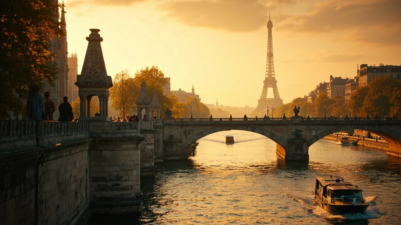
The history of Paris begins along the Seine, long before the modern city
Standing on a bridge over the Seine, it is possible to look at Paris as a single scene and still recognize several historical chapters. A medieval island settlement sits within the modern road network. Haussmann-era apartment blocks follow the logic of a nineteenth-century rebuilding program. Farther downstream, the iron frame of the Eiffel Tower points toward the era of international exhibitions and mass tourism. Beneath these visible layers lie Roman foundations, medieval lanes, revolutionary sites, and traces of a city repeatedly remade by war, politics, commerce, and migration.
The history of paris is therefore more than a sequence of famous rulers and revolutions. It is also a story about how a settlement on an island developed into a regional capital, an intellectual center, an imperial capital, and eventually one of the world’s most recognizable tourist destinations. For travelers, the most rewarding way to understand that story is to stop treating the city as a collection of landmarks and instead ask what each neighborhood, building, street plan, and river crossing reveals about the people who lived there before.
This timeline begins with traces of human occupation from the Mesolithic period and follows Paris through the Parisii, Roman Lutetia, the medieval city, religious conflict, revolution, Haussmann’s reconstruction, two world wars, and the modern metropolitan era. It also identifies places where those layers remain visible.
Prehistory, the Parisii, and Roman Lutetia
Archaeological evidence places human activity in the Paris area thousands of years before the city had a written civic identity. Excavations have revealed hunter-gatherer traces dating to about 8000 BC, later temporary settlements, and evidence of fishing communities along the Seine. Fragments of wooden canoes recovered in the Bercy area demonstrate that the river was used for movement and trade well before stone construction became prominent.
Between 250 and 225 BC, a people known as the Parisii settled along the Seine. Their precise location is debated, but Île de la Cité and the area around Nanterre are both plausible candidates. The settlement occupied a strategic position between river routes, and its control of bridges and crossings helped it prosper. The Parisii minted coins and traded with communities elsewhere in Europe.
The Roman conquest changed the settlement. After the Parisii resistance and the defeat of Lutetia in 52 BC, the Romans created a new administrative and military center known as Lutetia Parisiorum, or Lutetia of the Parisii. Much of the Roman town stood on the higher ground of the Left Bank, where flooding was less likely. Its forum, main civic buildings, baths, and street plan followed Roman conventions.
The For additional context, chronology of the city from its earliest settlement shows why the Seine was central to this development. Lutetia was not an isolated village. An aqueduct carried fresh water from the Rungis and Wissous area, while the river connected the settlement to a wider commercial system. Excavations have also revealed imported ingredients associated with Roman life, including olive oil, wine, shellfish, and garum.
Christianity appeared in the city during the third century, and the first securely recognized bishop was Victorinus in 346. A cathedral existed by 392. During later invasions, residents of the vulnerable Left Bank moved toward the safety of Île de la Cité. The shift is important because the island that now carries the oldest monumental core of Paris was also the site where Roman-era settlement and refuge overlapped.
Much of the Roman city survives below ground rather than in the skyline. The Roman amphitheater remains one of the clearest large-scale traces, while the Thermes de Cluny preserve the city’s relationship with bathing and water supply. Visitors seeking visible Roman remains can also examine archaeological displays connected with the Carnavalet Museum. These sites help explain why Paris can look medieval at street level while also possessing a Roman urban foundation.
The Frankish capital and medieval Paris
After the authority of the Roman Empire weakened, the Franks consolidated control over the region. Clovis I made Paris his capital in 508, giving the settlement a new political importance. The period that followed was not simply a pause between Roman and modern Paris. It transformed the city through monasteries, churches, markets, craft production, population growth, and the slow formation of a distinctive urban fabric.
The medieval city concentrated around the Île de la Cité and spread outward along the Seine. Churches became major landmarks and centers of learning. Notre-Dame Cathedral, begun in the 12th century, gave the island a monumental focus. The Sainte-Chapelle, created in the 13th century to house relics associated with the Passion of Christ, demonstrated the wealth and technical ambition of the royal court. Religious buildings were not simply places of worship; they were also political statements, gathering spaces, and symbols of authority.
Commercial activity expanded along the river and through specialized streets. Craftspeople, merchants, students, clergy, and servants lived in tightly packed quarters. Many streets were narrow, irregular, and difficult to distinguish from one another. The organized blocks and broad radial avenues seen today would look unrecognizable to a medieval resident.
Learning also became a defining feature of the city. The University of Paris, organized during the 13th century, became one of Europe’s earliest major universities. Its presence attracted students and teachers, adding an international dimension to Paris. The university’s later conflicts with religious and royal authority helped make the Left Bank an intellectual center, although the quarter of today’s Latin Quarter should not be treated as a frozen picture of the medieval past.
Paris faced severe disruption in the late medieval period. The Black Death arrived in the 14th century, causing enormous loss of life and disrupting economic and social life. The Hundred Years’ War then brought conflict to the region, including the occupation of Paris by Burgundian and English forces between 1418 and 1436. War and plague changed the city’s population and sharpened political divisions.
Visitors can still read the medieval Paris in three forms: the concentrated silhouette of Île de la Cité, surviving religious architecture, and the relationship between narrow streets and later boulevards. The medieval city is easiest to understand when it is treated as a functioning river settlement rather than a collection of medieval-looking tourist props.
Printing, religious conflict, and the royal capital
Paris became Europe’s leading center of book publishing during the 16th century. Printers, editors, scholars, and booksellers clustered around the university and other established neighborhoods. Printing changed the scale of intellectual exchange: ideas could circulate in greater numbers and reach readers beyond the immediate circle of teachers, clergy, and court officials.
Religious divisions sharpened during the French Wars of Religion. Catholic and Protestant conflict affected political alliances, public safety, architecture, and the distribution of power within the city. The conflict is an essential part of the history of paris because it shows that Paris’s monuments were repeatedly adapted, damaged, rebuilt, or repurposed as political allegiances changed.
The 17th century strengthened the image of Paris as a capital of royal administration and culture. Under Louis XIII and Louis XIV, the monarchy developed institutions that concentrated authority in the capital. Louis XIV used Versailles as his principal residence and seat of court, but royal power reshaped Paris as well. New squares, axial approaches, government offices, and elite residences reinforced the city’s rank as a political center.
The Place des Victoires and the Place Vendôme represent this period’s urban ambitions more clearly than a palace alone can. Their ordered geometry, broad spaces, and surrounding façades were designed to make royal authority visible in the city. Yet the seventeenth century also produced sharp inequalities. Grand residences stood close to crowded districts, and the social contrast was part of the capital’s character rather than a later invention.
The Académie française, founded in 1635, added to Paris’s identity as an intellectual and linguistic center. French increasingly became associated with the language used and refined in Parisian salons, academies, courts, and publishing houses. That influence was cultural as well as political: long after the monarchy fell, Paris remained associated with French language, criticism, fashion, and intellectual debate.
Revolution, empire, and a city remade by Haussmann
The French Revolution transformed Paris in 1789. The storming of the Bastille made the eastern edge of medieval Paris a symbol of the uprising, while political gatherings and the seizure of power unfolded in and around the city. The Hôtel de Ville became a center of revolutionary government, and the execution of Louis XVI in the Place de la Révolution, now the Place de la Concorde, tied the capital to the regime’s most dramatic decisions.
Paris remained unstable during the nineteenth century. Revolution again brought the city into the foreground in 1830 and 1848. Napoleon III’s government later entrusted Baron Georges-Eugène Haussmann with the reconstruction of much of central Paris. Between the 1850s and early 1870s, Haussmann’s program cut broad avenues through dense neighborhoods, created large intersections, replaced or standardized façades, and improved infrastructure including sewers, parks, and public services.
The scale of this change can be difficult to appreciate because the result feels natural to modern visitors. Before reconstruction, many central districts consisted of narrow medieval streets, crowded tenements, workshops, and irregular plots. Haussmann replaced this fabric with long straight routes, uniform building heights, corniced stone facades, and intersections designed to improve circulation and visibility. The city could now accommodate wider traffic and larger crowds, but displacement and the loss of older neighborhood patterns made the change deeply controversial.
Paris also expanded to its present administrative limits in 1860. This enlargement brought the surrounding communes into the city rather than merely adjusting the center. Administrative boundaries are easy to overlook on a map, yet they explain why the modern capital includes areas that developed as distinct towns, including Montmartre and Montparnasse.
The later nineteenth century added landmarks associated with the modern image of Paris. The Eiffel Tower was built for the 1889 Exposition Universelle. International exhibitions also helped establish the city as a center of engineering, design, and mass spectacle. The Palais Garnier, completed in the 1870s, presented Paris as a capital of spectacle and culture; the Musée d’Orsay later occupied a station on the same rail line that visitors now use to approach the city from the southwest.
Haussmann’s avenues made these monuments part of a coordinated urban composition. The boulevards offered axes, vistas, and large public spaces that framed major buildings. For travelers, walking one of these routes can reveal how nineteenth-century planning converted a difficult medieval city into a more legible capital. The experience also raises an important question: whether a beautiful ordered city is worth the human disruption required to create it.
World wars, reconstruction, and the modern metropolis
Paris was heavily affected by both world wars. During World War I, the city suffered bombing and military pressure while serving as a center of government, industry, finance, and humanitarian activity. Between the wars, Paris became a major focus for modern art, literature, cinema, and intellectual life. Its population reached a historic high of about 2.1 million in 1921, although the city’s population then declined for much of the twentieth century.
During World War II, German forces occupied Paris from 1940 until 1944. The occupation brought surveillance, requisitions, censorship, violence, and difficult choices for residents. Paris was not continuously destroyed, and its buildings often survived, but the war disrupted nearly every part of urban life. The city also participated in the wider French Resistance and the liberation of Paris in August 1944.
After the war, reconstruction and urban renewal transformed parts of the capital. The UNESCO headquarters opened in the 1950s on the Champ de Mars area, bringing an international institutional presence to the site of the Eiffel Tower. Major museums and cultural institutions also renewed the city’s postwar identity. The Centre Pompidou opened in 1977, the Musée d’Orsay opened as a museum in 1986, and the Louvre received its glass pyramid in 1989.
At the same time, the modern population map changed. Families became smaller, while many middle-income residents moved to the suburbs. In the first decades of the twenty-first century, the city’s population began to rise again as younger residents and newcomers settled within Paris. The 2005 unrest in housing projects in several surrounding suburbs also demonstrated that the history of Paris cannot be separated from the larger region around it.
Paris continued to face security crises, including the 2015 terrorist attacks, while adapting its public spaces and infrastructure. Modern transit is part of this continuing story. Métro stations, suburban rail lines, tramways, cycling routes, and pedestrianized areas connect the center with communes that would once have been independent settlements. Understanding these lines changes the way visitors move: the metropolis is not Paris plus a day trip, but a network of historically related urban places.
How to see the city’s major historical eras while traveling
A trip focused on Paris’s history works best when it uses visible evidence rather than simply collecting landmark names. A monument may introduce an era, but the surrounding street, river, or former boundary often explains how that era functioned. The following approach links major periods to the kinds of places visitors can encounter in the city.
| Historical era | What shaped Paris | Places where evidence remains | What to look for |
|---|---|---|---|
| Prehistory and the Parisii | River settlement, fishing, trade, and early iron-working communities | Archaeological collections and the Bercy area | Wooden canoes, settlement traces, and the Seine’s role in movement |
| Roman Lutetia | Roman planning, aqueducts, baths, forum, and regional administration | Roman amphitheater and Thermes de Cluny | Below-ground remains and the relationship between the Left Bank and the river |
| Medieval Paris | Island settlement, churches, trade, university learning, plague, and war | Île de la Cité, Notre-Dame, Sainte-Chapelle, and the Latin Quarter | Medieval scale, religious monuments, and old street alignments |
| Royal and religious conflict | Publishing, religious division, royal administration, and court culture | Sorbonne area, Place Vendôme, Place des Victoires, and Marais | Historic courtyards, hôtels particuliers, institutional buildings, and old commercial streets |
| Revolution and nineteenth-century rebuilding | Political upheaval, wide avenues, standardized facades, and new monuments | Hôtel de Ville, Place de la Concorde, Opera, Eiffel Tower, and grands boulevards | Axis planning, uniform cornices, broad intersections, and controlled vistas |
| Twentieth century to today | War, occupation, migration, metropolitan growth, museums, and transit | Montmartre, Montparnasse, museums, rail corridors, and outer arrondissements | Industrial history, interwar culture, modern architecture, and the wider metropolitan region |
A useful first walk should connect the Seine’s major crossings with the medieval and royal core. Île de la Cité provides the clearest concentration of early history, while the Latin Quarter shows how religion, scholarship, and the university shaped the Left Bank. Moving east to the Marais adds aristocratic residences, monastic land, working streets, and later commercial history. The route allows a visitor to understand how Paris expanded without losing sight of the river that organized it.
A second walk works well around the major nineteenth-century axes. Starting near the Opera and following the Grands Boulevards toward Place de la Concorde reveals Haussmann’s planning in the street width, façades, intersections, and sightlines. The route also introduces the political history of revolution, empire, public ceremony, and modern urban administration.
Third, travelers can compare the center with outer districts that developed beyond the old core. Montmartre, with its hilltop streets and windmills, developed around villages and pilgrimage sites before becoming associated with popular entertainment. Montparnasse was once a rural area later absorbed by the expanding capital. Looking at these districts helps explain why a Paris of twenty closely arranged administrative wards can still contain landscapes that feel suburban, village-like, or distinctly local.
For visitors with limited time, the following checklist prioritizes historical range rather than the number of stops:
- Choose one landmark associated with the medieval city and one associated with Haussmann-era reconstruction.
- Travel along the Seine by metro or riverboat to see how the river ordered development.
- Choose a museum or archaeological site that explains one period rather than skimming several exhibits.
- Walk at least one neighborhood away from the main monuments.
- Note changes in paving, building height, roofline, street width, and the direction of traffic.
- Use a map to check whether a visible boundary reflects an old village, estate, wall, rail line, or later subdivision.
One caution is worth keeping in mind: a polished present can hide the conflict beneath it. The broad avenues are also records of displacement, the symmetrical façades conceal lost neighborhoods, and the celebrated riverfront was once a working industrial edge. A good historical walk leaves room for both admiration and criticism.
Key turning points in the history of Paris
Paris developed through changes of scale and purpose. The settlement remained tied to the Seine, but its political role, population, intellectual influence, and physical form changed repeatedly. The most consequential turning points include:
- Mesolithic and Neolithic activity: Evidence of fishing, settlement, and exchange establishes a human presence in the Paris area thousands of years before the capital existed.
- The Parisii settlement: Control of the Seine and its crossings gave an Iron Age community commercial and strategic importance.
- Roman conquest and Lutetia: A planned Roman town with aqueducts, baths, civic buildings, and regional functions replaced the earlier settlement.
- Frankish rule and medieval growth: Paris became a royal center supported by churches, markets, monasteries, and the developing university.
- Plague and the Hundred Years’ War: Disease and warfare damaged population, economy, and political stability.
- Printing and religious conflict: Publishing made the city a major intellectual center, while civil war sharpened divisions over faith and authority.
- The French Revolution: The city became the principal stage of a political rupture that changed the meaning of citizenship, sovereignty, and urban space.
- Haussmann’s reconstruction: New boulevards, infrastructure, and building codes transformed the center and expanded the capital’s limits in 1860.
- World wars and occupation: Conflict disrupted daily life and left both destruction and stories of resistance in the modern city.
- The metropolitan city: Migration, suburban growth, transit, and cultural redevelopment made Paris part of a much larger urban region.
These events should not be treated as isolated dates. For example, Roman roads shaped later movement; medieval institutions supported later scholarship; royal centralization influenced revolutionary demands; and Haussmann’s rebuilding changed how residents and visitors experience the center today. Each era becomes less confusing when it is placed in relation to what came before and what it made possible afterward.
Paris compared with other cities shaped by geography and power
Paris is often treated as an exceptional case, but comparison makes its history clearer. Other cities also developed around rivers, ports, courts, trade routes, or strategic crossings. Their differences show which features of Paris came from its particular position in northern France and which reflect patterns common to urban history.
| Comparison | Shared historical pressure | Distinctive feature of each city | Useful traveling question |
|---|---|---|---|
| Paris and Moscow | Imperial capitals, political centralization, war, architectural rebuilding, and mass transit | Paris developed a dense river-centered form and a strong association with French intellectual and artistic movements; Moscow’s identity carries stronger layers of Orthodox, imperial, and Soviet history | How does each capital use monumental axes and central institutions to display authority? |
| Paris and Seoul | Rapid modernization, political upheaval, global cultural influence, and extensive metropolitan regions | Paris accumulated its modern street plan largely in the nineteenth century; Seoul’s explosive growth is closely tied to twentieth-century development and rapid reconstruction | Which urban spaces preserve older patterns after major redevelopment? |
| Paris and other river cities | Water supply, trade, sanitation, transport, flood risk, and leisure waterfronts | The Seine helped organize Paris, though its modern embankments were deliberately engineered rather than left as an untouched natural bank | How has the river been controlled, adapted, and used for public life? |
| Paris and former imperial capitals | Courts, embassies, museums, monumental avenues, and attempts to express national identity | Paris’s imagery repeatedly shifted among monarchy, republic, empire, and international culture | Which symbols remain when the political system that created them changes? |
For further context on how capitals can look very different despite sharing the same pressures, Moscow Russia Is Much Bigger Than Red Square illustrates the relationship between a central landmark and the much larger urban area surrounding it. The contrast with What Is Seoul? A City That Somehow Feels Ancient and Futuristic at Once is equally useful for considering how older patterns coexist with rapid modern development.
The central lesson is that cities do not grow in a straight line. Paris inherited routes, boundaries, institutions, and memories from earlier periods while repeatedly adding new systems on top. Its history is visible precisely because so many layers remain legible, even when they conflict.
Frequently asked questions
What is the earliest evidence of human settlement in Paris?
Archaeological discoveries place human activity in the Paris area at least as far back as about 8000 BC, during the Mesolithic period. Later settlements and the recovery of wooden canoes show that communities used the Seine for fishing and movement. These remains establish a human presence long before Paris became a named city or political capital.
When did the Parisii settle near the Seine?
The Parisii established themselves in the Iron Age, approximately between 250 and 225 BC. They built a fortified settlement, minted coins, and controlled an important river route. Their exact central settlement is debated, with Île de la Cité and the Nanterre area among the leading possibilities.
Why is Roman Paris called Lutetia?
Lutetia was the Roman name for the city established after the defeat of the Parisii in 52 BC. The name is commonly associated with a Celtic term referring to a marsh or swamp, although the exact derivation remains debated. Roman Lutetia was a regional center with a forum, baths, aqueduct-fed water system, and planned streets on the Left Bank.
When did Paris become France’s capital?
Paris had long been a royal and administrative center before it became the permanent capital of the French monarchy. Under Louis XIII, royal administration became more closely associated with the city, and the move of the court to Versailles under Louis XIV strengthened Paris’s political role even though Versailles became the main royal residence. The Revolution then made Paris the center of a new republic, and it has remained the national capital.
How did Haussmann change Paris?
Georges-Eugène Haussmann directed a vast rebuilding program that created broad avenues, large intersections, standardized building fronts, parks, sewers, and other infrastructure. The work improved circulation and sanitation but also displaced many residents and eliminated parts of the older medieval street pattern. The enlarged administrative city reached its current limits in 1860.
Which historical periods are easiest to see in central Paris?
Medieval and royal history is easiest to trace around Île de la Cité, the Latin Quarter, the Marais, Place Vendôme, and Place des Victoires. Haussmann’s rebuilding is visible along the major boulevards around the Opera, Place de la Concorde, and central commercial districts. Roman remains are less exposed and generally require visits to archaeological sites or museums.
Did the two world wars destroy most of Paris?
Paris suffered bombing, occupation, disruption, and economic hardship, but the city avoided the level of physical destruction seen in some other major wartime targets. The effects reached far beyond damaged buildings: rationing, displacement, resistance, collaboration, fear, and political uncertainty shaped daily life. Much of the visible center survived, while the twentieth-century story is also embedded in transit systems, memorial spaces, housing, and new cultural institutions.
Is the history of Paris only about famous monuments?
No. It also appears in street widths, building materials, neighborhood boundaries, former village centers, railway cuts, markets, religious sites, and changing views of the Seine. Roman Lutetia survives mainly through archaeology, while medieval Paris can be read in the relationship between the river and old routes. Haussmann-era Paris is particularly legible in its long vistas and coordinated façades.
How long does it take to understand Paris’s history?
A single well-chosen day can reveal the basic sequence, but deeper understanding benefits from at least two walks in different parts of the city and one museum focused on a single period. History of paris becomes clearer when travelers compare the royal islands, the medieval university district, Haussmann’s boulevards, and an outer commune that developed separately before becoming part of the capital.
Leave a Reply